maandag 27 september 2010

The wolf as the indicator specie for the afforestation of Europe


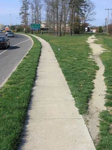
The last time a wolf was seen in the Netherlands was in 1869 but it is expected that they will be permanently re-entering within 10 to 15 years. They will probably arrive from Germany where they have established themselves again after a century of absence in the year 2000, or perhaps from the South of France via Belgium. Excellent! One of the reasons for this optimism is the above image of GPS collared wolf Allan, born in Germany, who only needed six months to travel the 15000 km to Belarus, in the process several times crossing the border with Poland, one of the most heavily guarded in the entire EU. Experts say that because of the evasive character of the wolf it they may have already passed through the country without anybody noticing.

As the environment commission of the EU notes "Nature does not respect the borders that humans draw on maps" and the possible return of the wolf to the Netherlands is related to demographical developments elsewhere. Stefan Theil writes at MSNBC.com about how depopulation, urbanization and afforestation in nearly every country on the European continent creates large news habitats for animals like the wolf.


Listen to Stefan Theil:
Wolves returning to the heart of Europe? A hundred years ago, a burgeoning, land-hungry population killed off the last of Germany's wolves. Today, it's the local humans whose numbers are under threat. Wolf-country villages like Boxberg and Weisswasser are emptying out, thanks to the region's ultralow birthrate and continued rural flight. Nearby Hoyerswerda is Germany's fastest-shrinking town, losing 25,000 of its 70,000 residents in the last 15 years.
Such numbers are a harbinger of the future. Home to 22 of the world's 25 lowest-birthrate countries, Europe will lose 41 million people by 2030 even with continued immigration, according to the latest U.N. Population Division report. The biggest decline will hit rural Europe. As Italians, Spaniards, Germans and others produce barely half the children needed to maintain the status quo—and rural flight continues to suck people into Europe's suburbs and cities—the countryside will lose close to a third of its population, say both the United Nations and the EU. 
Rising economic pressures will amplify the trend. One third of Europe's farmland is marginal, from the cold northern plains to the parched Mediterranean hills. Most of these farmers subsist on EU subsidies, since it's cheaper to import food from abroad. Already, the EU is trying to limit costly overproduction by paying farmers not to farm. "Without subsidies, some of the most scenic European landscapes would not survive," says Jan-Erik Petersen, a landscape biologist at the European Environmental Agency in Copenhagen. Take the Austrian or Swiss Alps. Defined for centuries by orchards, cows and high mountain pastures, those steep valleys are labor-intensive to farm, with subsidies paying up to 90 percent of the cost. The Austrians and Swiss pay up so that the postcard-perfect scenes can continue to exist. Across the border in France and Italy, subsidies have been reduced for mountain-farming. Since then, all across the southern Alps, villages have emptied out and forests have grown back in.

This isn't necessarily the environmentalist's dream it might seem. The scrub brush and forest that grows on abandoned land might be good for deer and wolves, but is vastly less species-rich than traditional farming, with its pastures, ponds and hedges. "Once shrubs cover everything, you lose the meadow habitat. All the flowers, herbs, birds and butterflies disappear," says the EEA's Petersen. "A new forest doesn't get diverse until it's a couple of hundred years old." An odd alliance of farmers and environmentalists have joined to put pressure on the EU to "keep the landscape open," as World Wildlife Fund spokeswoman Catherine Bett calls it. Keeping biodiversity up by preventing the land from going wild is one of the reasons the EU pays farmers to mow fallow land once a year. France and Germany subsidize sheep herds whose grazing keeps scenic heaths from growing in. Outside the range of these subsidies—in Bulgaria, Romania or Ukraine—big tracts of land are returning to the wild.
Many Europeans are reluctant to just let nature do its thing. "We still cry when the woods close in."


Distribution of wolves in Europe 


Reader John Grzinich of MoKS recently mailed in the following infographic that shows that the nation of Estonia is for 51% covered with forest. John further writes that the overall size of the forest has been increasing for the last 100 years but especially after the Estonian independence. The percentage of protected parks is growing as well.


The wolves are doing so well in places according to the National Wildlife Foundation that they are overpopulating their territories and the obvious result is that they are spreading out. But how are we to co-exist with the wolf? The Astana country of Kazakhstan points to way:

the Kazakhs, who admire wolves for their cunning and courage, bear them no grudge. A tour of an area where many wolf attacks have been reported found everyone horrified at the suggestion that perhaps the wolf should be eradicated as it was in the United States and Western Europe. "There are just too many, that's all," said Galina Yakovna, who had watched helplessly as a pair of wolves recently snatched her favorite dog from her yard. "But they are part of nature."

Afforestation 1990-2000 according to European Environment Agency

zaterdag 25 september 2010

The Crypto-Forests of Utrecht

Here is a charming little cryptoforest I once located on the Zeedijk on my way by bike to another part of town where I went to search for them (but of course didn't find any). It is about 5 meters wide, the fence is recent, and it is either an abandoned garden or an old entrance to the wood factory behind. The first few meters are paved, weeded with without trees, one picture shows this clear demarcation. Knowing the intense demand for space in this town I think of this, in a way, as the quintessential cryptoforest.


donderdag 23 september 2010

We don't need to see anything out of the ordinary. We already see so much.

Listen to Robert Walser (A Little ramble, 1914):
I walked through the mountains today. The weather was damp, and the entire region was grey. But the road was soft and in places very clean. At first I had my coat on; soon, however, I pulled it off, folded it together, and laid it upon my arm. The walk on the wonderful road gave me more and even more pleasure; first it went up and then descended again. the mountainous world appeared to me like an enormous theatre. The road snuggled up splendidly to the mountainsides. Then I came down into a deep ravine, a river roared at my feet, a train rushed past me with magnificent white smoke. The road went through the ravine like a smooth white stream, and as I walked on, to me it was as if the narrow valley were bending and winding around itself. Grey clouds lay on the mountains as though that were their resting place. I met a young traveller with a rucksack on his back, who asked if I had seen two other young fellows. No, I said. Had I come here from very far? Yes, I said, and went farther on my way. Not a long time, and I saw and heard the two young wanderers pass by with music. A village was especially beautiful with humble dwellings set thickly under the white cliffs. I encountered a few carts, otherwise nothing, and I had seen some children on the highway. We don't need to see anything out of the ordinary. We already see so much.
Reintroduced by Susan Sontag in a splendid essay, Robert Walser remains favouritely obscure like the best grindmetal bands. As Rivka Galchen asks "How immense can modesty be."

woensdag 22 september 2010

Thoreau and Cryptoforest Philosophy

Thoreau's walden, the stones mark the location of his cottage.


Listen to Henry David Thoreau (Chesuncook part six) and let's capitalize the key words:
The kings of England formerly had their forests ‘to hold the king’s game,’ for sport or food, sometimes destroying villages to create or extend them; and I think that they were impelled by a true instinct. Why should not we, who have renounced the king's authority, have our national preserves, where no villages need be destroyed, in which the bear and panther, and some even of the hunter race, may still exist, and not be ‘civilized off the face of the earth,’ — our forests, not to hold the king's game merely, but to hold and preserve the king himself also, the lord of creation, — not for idle sport or food, but for inspiration and our own true re-creation? or shall we, like villains, grub them all up, poaching on our own national domains?
Here is another random quote:
In fact, the deeper you penetrate into the woods, the more intelligent, and, in one sense, less countrified do you find the inhabitants; for always the pioneer has been a traveler, and, to some extent, a man of the world; and, as the distances with which he is familiar are greater, so is his information more general and far reaching than the villager’s.

The Anarchic Indian


In 1952/53 the American evangelist Elisabeth Elliot, working with the SIL, goes to Ecuador to translate the bible in the language of the Colorado Indians. The first half of this book deals with the inconveniences of jungle life, the second part deals with the inconveniences of a missionaries life in the jungle. The first fifty pages deal with housemaking. The last 70 pages reveals a shocking inability to relate to other realities than that of a middle-class American housewife doped on God. She just can't understand with an arrogance and blindness that is revolting. However, I find the opening paragraph of the following section a perfect reason to study Amazonian Indian culture and philosophy: 
It became clear that nobody really intended to work for me. The truth was that Colorados never work for anybody. Some of them in fact had white men working for them. They were wealthy because of the export of bananas and anchiote, the latter for the colouring of margarine. Money meant very little. They had lived near white man for centuries and they had plenty of opportunities to assess the white's man way of life. A good hard look was enough. They did not like it. They chose to keep their own way, spending money only for a few things like salt, kerosene, Vaseline, cotton thread, and gin. They had not the slightest urge to dress like white men, or build houses like theirs, or submit themselves to their economic slavery, and nothing would persuade them otherwise.


I was embarrassed and offended by this higher criticism. Nothing had prepared me for it. I was here to help and these people would not be helped. I had no doubt that God was on my side, and this was a secret satisfaction. Someday God and I would show these proud, independent Indians that we had plans for them, plans they would not ultimately succeed in thwarting. One way or another (God would show me the way) I would get hold of the language, make it my own, harness it into an alphabet, and make of the Indians readers and writers. This would surely happen. But getting them to acknowledge that they were living in 'bondage, sorrow, and night' was going to be a lengthy process. They were not interested, not in the least, in our definition of liberation. Besides, time was always on their side. White men came and went with their plans an projects. They were a nuisance while they were around, but the Indians knew how to get out of their way and live their hidden lives.


I did what any Christian in trouble would do: I prayed.

dinsdag 21 september 2010

The Green Mountain [A terra-formed forest]

The story of Ascension Island's transformation from a totally treeless "cinder" as Charles darwin found it in July 1836 to the rich vegetation of its rain-forming cloud forest at Green Mountain begins with an English botanist named Joseph Hooker who visited the island in 1843.

Listen to D.M. Wilkinson (The parable of Green Mountain: Ascension Island, ecosystem construction and ecological fitting):

...at the request of the British Admiralty, made recommendations to ‘improve’ the Ascension environment. Hooker presented four main suggestions (Duffey, 1964):

1. Planting trees on the mountain which he considered ‘of the first importance as thereby the fall of rain will be directly increased’.

2. Developing the formation of deeper soils by encouraging more vegetation to grow on the steeper slopes.

3. Planting the more promising areas in the lower valleys with drought adapted trees and shrubs.

4. Introducing suitable crops into gardens on Green Mountain.

The thinking behind this scheme is strikingly similar to much more recent ideas for creating life-friendly conditions on Mars (so-called terraforming), where the idea ‘should not just be about creating a new environment for life through force majeure, but about finding ways to allow life to create a new environment for itself’ (Morton, 2002, p. 298). The idea that trees promote rainfall, and so improve their own environment, dates from measurements of transpiration rates at the start of the eighteenth century and became an influential idea amongst many administrators of the British Empire (Grove & Rackham, 2001). However, on Green Mountain, the trees probably mainly increase occult precipitation by trapping moisture from the regular mists.

For several years after Hooker’s visit, consignments of plants were sent to Ascension every month and, after 1850, twice a year, from England each November and from the Cape of Good Hope each May (Duffey, 1964). Such was the success of this scheme that Alistair Hardy could describe the vegetation of Green Mountain in the 1920s as ‘good and hearty’, writing that ‘tall eucalyptus trees now lined the road, flowering shrubs, conifers and palms of many kinds appeared, and sheep grazed on the slopes of grass in between patches of almost dense jungle’ (Hardy, 1967, p. 124).
Today, much of the higher parts of Green Mountain are best described as cloud forest, contrasting strikingly with Darwin’s complaint of a landscape ‘entirely devoid of trees’. Indeed the mountain is dominated by introduced plant species. Hooker later had second thoughts about the conservation implications of his ‘terraforming’ scheme, writing: ‘The consequences to the native vegetation of the Peak will, I fear, be fatal, and especially to the rich carpet of ferns that clothed the top of the mountain when I visited it’
& The lesson is:
The Green Mountain system is a spectacular example of ecological fitting. It shows that coevolution is not necessary to the development of a complex ecosystem, although it should be noted that this does not necessarily mean that it is never important. It should also make us more sceptical of arguments based on long histories of coevolution that are sometimes used to explain high levels of tropical biodiversity. On Green Mountain, where humans have solved the plant-dispersal problems, the system has gone from species poor ferndominated hillsides to species-rich cloud forest in around 150 years.

zondag 19 september 2010

The Crypto-Forests of Utrecht

The first principle of cryptoforestry is that you can't search for a cryptoforest, you can only find them serendipitously. The following pictures are from a large, well-used cryptoforest at the near end of the Amsterdamsestraatweg that I first came across when going to a meeting and lost my bearing (even though I had been to that address twice before) and spotted this spontaneous park. It is a triangular plot next to the busy Amsterdam Rijnkanaal and it's obviously popular. The entrance is still open, with high grass and only a few trees, the end, which offers no way to get out of it has young but high trees.

Maps Google image of the forest in 2005. Already it shows the billboard advertising a property
development scheme but the actual building is still fortcoming. 

The same billboard. 
A overgrown desire path leading to the end of the plot.
The entrance.
Clearly deeply eroded path.

Desire Paths

Desire paths? The only way of navigating a cryptoforest. Listen to Wikipedia, see them collected here and as elephant paths here:

A desire path (also known as a desire line or social trail) is a path developed by erosion caused by animal or human footfall. The path usually represents the shortest or most easily navigated route between an origin and destination. The width and amount of erosion of the line represents the amount of demand. Desire paths can usually be found as shortcuts where constructed pathways take a circuitous route.

Before moving on to others pastures listen to Henri Thoreau:

If a man does not keep pace with his companions, perhaps it is because he hears a different drummer. Let him step to the music which he hears, however measured or far away.
Listen to Clark L. Erickson (Agency, Causeways, Canals, and the Landscapes of Everyday Life in the Bolivian Amazon) on recent and old canoe-dragging desire paths in the Bautes Hydraulic Complex in Bolivia: 
Minor Causeways-Canals were also laid out in straight alignments but are shorter in length and required less construction than the Major Causeways-Canals. These features consist of a single shallow canal (1 m wide and less than 0.5 m deep) with low causeways or berms alongside . My informant-guides and I interpret these shallow canals as precolumbian canoe paths: channels for paddling or poling large canoes across the shallow inundated savanna during the wet season. During the dry season, the channels could be used as routes for pedestrian traffic through savanna grasses. Repeated paddling, poling, or dragging a large canoe through the shallow water can create canal-like depressions over time with minimal planning or labor. The irregular scar of annual canoe transit of my native guides is a good example of what a few hunters can do through even irregular routines over many years. Their paths have been permanently etched on the landscape as a modern layer of palimpsest. I can trace their recent canoe path across the savanna to their forest island camp on satellite imagery, a distance of 7 km. The sinuous irregular courses of these recent canoe paths stand in contrast to the straight trajectory of Minor Causeways-Canals, which implies concern with trajectory during the initial shallow channel excavation.
Paths between forest islands
Desire paths are also known as elephant trails, the Sketchglass website offers screenshots of a BBC documentary displaying real elephant paths. WOW:


Elephant GPS Trails
The website of the Virunga National Park in Congo offers pictures of the damage done to a forest environment when a herd of elephants comes storming through:
A tree knocked down
A Hole in the canopy
From the ecosystem upsetting elephant it is only a small step to an interview with Harald Beck on the crucial Mongabay website. Beck researches the peccary, a frolic little swarming bush pig that creates wallows,  desire swimming pools? 
Listen to Harald Beck:
At the Cocha Cashu field station in the Manu National Park, my students and I tested if peccaries were ecosystem engineers by creating and maintaining wallows, water filled depressions in the forest floor that typically range from 1 to over 50 square meters (photo). Peccaries may use wallows to cool down and to reduce the parasite load, or just because it is fun to splash in water and roll around in mud. 
Interestingly, the oldest wallow is over 17 years old! This means that numerous generations of peccaries use the same wallows and pass their locations on to the next generation. Over time wallows become larger and deeper as peccaries compact the soil and widen the edge. Wallows can be easily distinguished from natural ponds by signs of peccary wallowing activities, such as footprints or mud spray on the surrounding vegetation. Because of their trampling, no plants or even leaf litter are on the floor. In most rainforests during the dry season, standing water bodies are scarce on the forest floor, therefore peccary wallows could be critical aquatic habitat and breeding sites for insect and frog species. 
Wallows had consistently higher water surface area than naturally occurring ponds. This is also critical because it means that wallows are more stable and predictable habitats than ponds. So given the choice of laying eggs in a stable wallow or soon dried up pond, where would you go? With that in mind, it was not too surprising that wallows had a significantly higher density of tadpoles, metamorphs ("tadpoles" with legs and ready to conquer the land), and adult frogs. Furthermore, more species of all three frog life stages occurred in wallows than they did in ponds. 
We also found other species in wallows, including numerous aquatic insects (i.e. beetles, dragonflies, mosquito larvae, and even a semi-aquatic cricket!), and spiders that glide across the water surface and hunt prey. We also found mussels, at least nine different species of fish, and two species of snakes. This year we installed motion-triggered cameras and captured bats skimming across the water surface


However, nothing beats this example of a Crocodile wallow in the Northern Territory in Australia, can you spot the croc?


donderdag 16 september 2010

Qoutes about Deep Forest Psychology

We often read, in books of travels, of the silence and gloom of the Brazilian forests. They are realities, and the impression deepens on a longer acquaintance. The few sounds of birds are of that pensive or mysterious character which intensifies the feeling of solitude rather than imparts a sense of life and cheerfulness. Sometimes, in the midst of the stillness, a sudden yell or scream will startle one ; this comes from some defenceless fruit - eating animal, which is pounced upon by a tiger-cut or stealthy boa-constrictor.. Morning and evening the howling monkeys make a most fearful and harrowing noise, under which it is difficult to keep up one's buoyancy of spirit. The feeling of inhospitable wildness which the forest is calculated to inspire is increased tenfold under this fearful uproar. Often, even in the still hours of midday, a sudden crash will be heard resounding far through the wilderness, as some great bough or entire tree falls to the ground. There are, besides, many sounds which it is impossible to account for. 
I found the natives generally as much at a loss in this respect as myself. Sometimes a sound is heard like the clang of an iron bar against a hard, hollow tree, or a piercing cry rends the air; these are not repeated, and the succeeding silence tends to heighten the unpleasant impression which they make on the mind. With the native it is always the Curupira, the wild man or spirit of the forest, which produces all noises they are unable to explain. For myths are the rude theories which mankind, in the infancy of knowledge, invent to explain natural phenomena. The Curupira is a mysterious being, whose attributes are uncertain, for they vary according to locality. Sometimes he is described as a kind of orang-otang, being covered with long shaggy hair, and living in trees. At others he is said to have cloven feet and a bright red face. He has a wife and children, and sometimes comes down to the rocas to steal the mandioca. At one time I had a mameluco youth in my service, whose head was full of the legends and superstitions of the country. He always went with me into the forest ; in fact, I could not get him to go alone, and whenever we heard any of the strange noises mentioned above, he used to tremble with fear. He would crouch down behind me, and beg of me to turn back ; his alarm ceasing only after he had made a charm to protect us from the Curupira. For this purpose he took a young palm-leaf, plaited it, and formed it into a ring, which he hung to a branch on our track. At length, after a six hours' walk, we arrived at our destination, the last mile or two having been again through second-growth forest.
Listen to Alejo Carpentier (The Lost Steps, 1953):
[The worm] ...Something like a baleful pollen in he air - a ghost pollen - impalpable rot, enveloping decay - suddenly became active with mysterious design, opening what was closed, closing what was opened, upsetting calculations, contradicting specific gravity, making guarantees worthless. One morning the ampoules of serum in hospital were found to be full of mould; precision instruments were not registering correctly; certain liquors began to bubble in the bottle; the Rubens in the National Museum was attacked by an unknown parasite immune to sprays;  windows stormed the windows of a bank where nothing had happened, whipped to a panic by a mutterings of an old Negro crone whom the police were unable to find.
[The vegetable kingdom] ... Despite the vast area of the jungle - embracing mountains, abysses, treasures, nomad people, the remains of the lost civilizations, it was, nevertheless, a world compact, complete, which fed its fauna and its men, shapes its own clouds, assembles its meteors, brought on its rain. A hidden nation, a map in code, a vast vegetable kingdom, with few entrances. 'Sort of like Noah's Ark, where all the animals of the earth could fit, but with only a small door', the little man added. 
[The mimetism of virgin nature] ...What amazed me most was the inexhaustible mimetism of virgin nature. Everything here seemed something else, thus creating a world of appearances that concealed reality, casting doubt on many truths. The alligator lurking in the depth of swamps, motionless, jaws ready, seemed rotten, scale-covered logs. The vines seemed snakes, the snakes vines when their skins did not simulate the grains of precious woods, their eyes the markings of moth wings, there scales those of the pineapple or coral rings. The aquatic plants formed a thick carpet, hiding the water that flowed below, mimicking the vegetation of the solid earth. The fallen bark soon acquired the consistency of pickled laurel leaves, and the fungi were like congealed copper drippings sprinkled with sulphur. The chameleons were twigs, lapis lazuli, lead brightly striped in yellow, imitating the splashes of sunlight filtering through the leaves, which never allow it to come through fully. The jungle is a world of deceit, subterfuge, duplicity, everything there is disguise, stratagem, artifice, metamorphosis. The world of the lizard-cucumber, the chestnut-hedgehog, the cocoon-centipede, the carrot-larva, the electric fish that electrocutes from the dregs of the slime.
[EthnoPoetic discovery] ... And in the vast jungle filling with night terrors, there arose the Word. A word that was more than a word. A word that imitated the voice of the speaker and of that attributed to the spirit in possession of the corpse. One came from the throat of the shaman, the other from his belly. One was deep and confused like the bubbling of underground lava; the other, medium in pitch, was harsh and wrathful. They alternated, they answered each other. The one upbraided while the other groaned, the belly voice turned sarcastic when the throat voice seemed to plead. Sounds like guttural portamenti were heard, ending in howls; syllables repeated over and over coming to create a kind of rhythm; there were trills suddenly interrupted by four notes that were the embryo of a melody. But then came the vibration of the tongue, the indrawn snoring, the panting contrapuntal to the rattle of the maraca. This was something far beyond language, and yet still far from song. Something that had not yet discovered vocalization, but was more than word.

Listen to Claudio Villas Boas (as quoted in Adrian Cowell's 'The tribe that hides from man') about the psychological, and not the material, need that isolated indians in the Amazon feel to make contact with white intruders:
 As long as we are here, we are calling to them. in the emptiness of the jungle, our human nature is a magnet to theirs. In this way, human groups have always been drawn to other groups, till after thousands of years the whole of mankind now lives in a world civilization. It's only those which are dominated by an extreme fear that remain outside and this is the sort of fear that thrives in the emptiness of the jungle. If people say that every month in the jungle shows its strain on me, them how much more on the Kreen-Akrore, who've been alone for hundreds of years? We must be patient and continue calling to them. Somewhere they are watching us and calling to us.

Listen to Joseph Conrad (The Congo interlude):
Going up that river was like traveling back to the earliest beginnings of the world, when vegetation rioted on the earth and the big trees were kings. An empty stream, a great silence, an impenetrable forest. The air was warm, thick, heavy, sluggish. There was no joy in the brilliance of sunshine. The long stretches of the waterway ran on, deserted, into the gloom of overshadowed distances. On silvery sandbanks hippos and alligators sunned themselves side by side. The broadening waters flowed through a mob of wooded islands; you lost your way on that river as you would in a desert, and butted all day long against shoals, trying to find the channel, till you thought yourself bewitched and cut off for ever from everything you had known once--somewhere--far away--in another existence perhaps. There were moments when one's past came back to one, as it will sometimes when you have not a moment to spare to yourself; but it came in the shape of an unrestful and noisy dream, remembered with wonder amongst the overwhelming realities of this strange world of plants, and water, and silence. And this stillness of life did not in the least resemble a peace. It was the stillness of an implacable force brooding over an inscrutable intention. 

The city as cryptoforest


The argument proposed by Robert Sullivan in his NY Magazine article 'The concrete jungle' is that the city of New York is a hotspot for biological diversity is not in itself new. It reminded me of the shifting emphasis in Amazonian anthropology from artefact to landscape.

Listen to Robert Sullivan:
In fact—and this may seem implausible—nature is in many ways more plentiful in New York City than it is in the surrounding suburbs and rural counties. New York is again a capital of nature; we are an ecological hot spot. 
How can this be possible? What does the grimy coast of Queens have over the fields and forests of Dutchess County? The answer is the same thing the city has: variety. While upstate nature may be robust and all-encompassing, it is also, from an ecological point of view, relatively barren—a small and fairly static number of species coexisting in a scenic but manicured wilderness. This is true for most of America’s wide-open spaces. “People think of the rural as this pristine, untouched place, when it’s actually highly controlled and highly engineered space,” says Nette Compton, a senior project manager at the Parks Department. “The fact is urban areas are not as well controlled. They are messy. There is diversity.”


In the city, we live in a nature that is even more resourceful and resilient than we have ever imagined. And when you look at nature that way, of course there are coyotes in New York. Look at all the forests and small mammals—not just rats, but also voles, chipmunks, and small red foxes—with whom we share the city. The question becomes: Where has the coyote been, and why are we so reluctant to have him? Why can’t we see the nature that we are living in?

In other words, the city’s forests are mostly an accident. “In a lot of ways, they are here because we are lucky,” says Wenskus. “After 300 years of Western man basically doing his thing, we still have these amazing forests that are predominantly intact—or as intact as they can be with 8 million people.” Recently, however, scientists have come to suspect that urban forests have thrived not despite their urban environment but because of it. “The old idea was that urban areas are not ecologically interesting or don’t have ecological processes, and that’s false,” says Richard Pouyat, who studies urban forests for the U.S. Forest Service. “The difference is, it’s been altered.” And altering the natural landscape isn’t always a bad thing.


Take fires. Alley Pond experienced many car fires over the years, and this is now understood to have played an important role in the forest’s ecological health. In some parts of Alley Pond Park, as well as in forests in the Bronx and Staten Island, open forest canopies encouraged sensitive species like upland sandpipers or a threatened suite of plants like purple and green milkweeds. In a 1996 article in Restoration & Management Notes, Marc Matsil and Mike Feller, an early NRG naturalist, called arsonists “New York City’s incidental restorationists.”


Urban forests are healthier than their suburban peers in other ways, too. The flora scene is more diverse. Much of the soil found in places like Alley Pond Park is pristine compared to suburban areas. Perhaps more interesting, from the point of view of the larger urban ecosystem, our forests have evolved to become more productive. According to a study comparing oak-tree stands in rural Connecticut with ones in New York City, city forests carry more of the metals associated with air pollution into the soil.

The cryptic cryptoforests of Plymouth and Utrecht

Overgrown residential houses are a special case of cryptoforestry: their status as cryptoforests is cryptic; their function is always (?) the expression of unhappiness and social inconvenience.

'It's so bad, it's worse than the Berlin Wall'
Petr provided the link to the Plymouth ferns above, and they reminded me of these pictures below of a nearly invisible house in Utrecht (Amsterdamsestraatweg).

woensdag 15 september 2010

The Garden Cities of Xingu

Kuhikugu, the forest city of the Xingu is the Transition Town of the future, here are some sources.

Listen to Michael Heckenberger et al (Amazonia 1492: Pristine Forest or Cultural Parkland?) :
Was the Amazon a natural forest in 1492, sparsely populated and essentially pristine, as has been traditionally thought? Or, instead, were parts of it densely settled and better viewed as cultural forests, including large agricultural areas, open parklands, and working forests associated with large, regional polities. Despite growing popularity for the latter view, entrenched debates regarding pre-Columbian cultural and ecological variation in the region remain unresolved due to a lack of well-documented case studies. Here, we present clear evidence of large, regional social formations [circa (c.) 1250 to 1600 A.D.] and their substantial influence on the landscape, where they have altered much of the local forest cover.  

We use a definition of early urbanism that is not limited to cities, meaning megacenters (5000 or more persons) distinctive in form and function from rural or suburban communities, but that also includes multicentric networked settlement patterns, including smaller centers or towns.

Rather than ancient cities, complex settlement patterns in the Upper Xingu were characterized by a network of permanent plaza communities integrated in territorial polities (~250 km2). This dispersed, multicentric pattern of plaza towns (~20 to 50 ha) and villages (<10 ha) was organized in a nested hierarchy, which gravitated toward an exemplary political ritual center. We refer to these hierarchical supralocal communities as galactic clusters, inspired by Tambiah’s “galactic polity” model, which draws attention to the basic similarities between small-to-large centers and the “radial mapping” of satellites in relation to an exemplary center. The galactic clusters existed within a regional peer polity composed of geographically and socially articulated but independent polities that shared basic features of techno-economy, sociopolitical organization, and ideology.
and

Long ago, Howard proposed a model for lower-density urban development, a “garden city,” designed to promote sustainable urban growth .The model proposed networks of small and wellplanned towns, a “green belt” of agricultural and forest land, and a subtle gradient between urban and rural areas. The pre-Columbian polities of the Upper Xingu developed such a system, uniquely adapted to the forested environments of the southern Amazon.
The Upper Xingu is one of the largest contiguous tracts of transitional forest in the southern Amazon [the so-called “arc of deforestation”], our findings emphasize that understanding long-term change in human-natural systems has critical implications for questions of biodiversity, ecological resilience, and sustainability. Local semi-intensive land use provides “homegrown” strategies of resource management that merit consideration in current models and applications of imported technologies, including restoration of tropical forest areas. This is particularly important in indigenous areas, which constitute over 20% of the Brazilian Amazon and “are currently the most important barrier to deforestation”.
Finally, the recognition of complex social formations, such as those of the Upper Xingu, emphasizes the need to recognize the histories, cultural rights, and concerns of indigenous peoples—the original architects and contemporary stewards of these anthropogenic landscapes—in discussions of Amazonian futures. proposed a model for lower-density urban development, a “garden city,” designed to promote sustainable urban growth. The model proposed networks of small and wellplanned towns, a “green belt” of agricultural and forest land, and a subtle gradient between urban and rural areas. The pre-Columbian polities of the Upper Xingu developed such a system, uniquely adapted to the forested environments of the southern Amazon.

In pre-Columbian villages, we can expect that the landscape was much more densely occupied and used more intensively and according to more rigidly defined divisions and schedules. Where today (2006) there are three villages of about 500 people (with only one of 350 a decade earlier), there were over 20 settlements in at least two clusters, with the larger first-order settlements ranging over 10 times the residential area of the modern Kuikuro village. These multi-centric settlement hierarchies encompass a small territory of about 400 km2. It is hard to say what the exact scale of communities or regional populations was, but the size and configuration of the settlements themselves is quite clear. Plaza villages, like today, were critical social nodes and tied into elaborate socio-political networks. Primary roads and bridges are oriented to plazas, or more accurately, are ordered by the same spatial principles, which also order domestic and public space, creating a cartography and landscape that was highly partitioned and rigidly organized according to the layouts of settlements and roads.

These areas of heightened alteration and management (saturated anthropogenic landscapes) can be readily seen in altered forest signatures on the landscape, as seen on the ground or in satellite images. The anthropogenic footprint of late prehistoric occupations is still clear today, even in the areas little used by contemporary Kuikuro communities. Rather than some delicate balance forged from millennia of almost changeless human use of the landscape, with almost imperceptible impacts on the forest, indigenous groups in the southern Amazon have a remarkable and indelible footprint. The scars of previous occupations, clear on satellite images, provide graphic testimony to what was lost, and underscore the need to consider human factors in the constitution of biodiversity and ecological zones.

Diagram of Ebenezer Howard's Victoriana Urbanism.


“Anthropologists made the mistake of coming into the Amazon in the twentieth century and seeing only small tribes and saying, ‘Well, that’s all there is.’ The problem is that, by then, many Indian populations had already been wiped out by what was essentially a holocaust from European contact. That’s why the first Europeans in the Amazon described such massive settlements that, later, no one could ever find.” 
As we walked back into the Kuikuro village, Heckenberger stopped at the edge of the plaza and told me to examine it closely. He said that the civilization that had built the giant settlements had been nearly annihilated. Yet a small number of descendants had survived, and we were no doubt among them. For a thousand years, he said, the Xinguanos had maintained artistic and cultural traditions from this highly advanced, highly structured civilization. He said, for instance, that the present-day Kuikuro village was still organized along east and west cardinal points and its paths were aligned at right angles, though its residents no longer knew why this was the preferred pattern. Heckenberger added that he had taken a piece of pottery from the ruins and shown it to a local maker of ceramics. It was so similar to present-day pottery, with its painted exterior and reddish clay, that the potter insisted that it had been made recently. 
As Pinage and I headed toward the chief’s house, Heckenberger picked up a contemporary ceramic pot and ran his hand along the edge, where there were grooves. “They’re from boiling the toxins out of manioc,” he said. He had detected the same feature in the ancient pots. “That means that a thousand years ago people in this civilization had the same staple of diet,” he said. He began to go through the house, finding parallels between the ancient civilization and its remnants today: the clay statues, the thatched walls and roofs, the cotton hammocks. “To tell you the honest-to-God truth, I don’t think there is anywhere in the world where there isn’t written history where the continuity is so clear as right here,” Heckenberger said.
Some of the musicians and dancers were circling through the plaza, and Heckenberger said that everywhere you looked in the Kuikuro village “you can see the past in the present.” 


Written on the land (geoglyphs & others)


Amazonian Geoglyphs number in the thousands and are truly spectacular, let's look at the sources and find a google.map here and the Portguese website of Denise Schaan here.

Ring ditch sites are reported in the Bolivian Amazon, Matto Grosso, Acre, and Upper Xingu River regions (Erickson 2002; Heckenberger 2005; Parssinen et al. 2003; Ranzi and Aguiar 2004). These sites consist of a closed or U-shaped ditched enclosure or multiple ditches. Heckenberger (2005) describes numerous sites with large open plazas and radial roads marked by earthen berms extending through residential sectors enclosed by deep semicircular moat-like ditches and embankments. Early explorers described villages that were protected by wooden palisades and moats. If palisaded, a typical ring ditch site would require of hundreds or thousands of tree trunks, a considerable environmental impact. Ring ditch sites in Acre and the Bolivian Amazon, described as geoglyphs because of their impressive patterns (circular, oval, octagon, square, rectangle, and D-shapes), appear to be more ceremonial than residential or defensive. Some ring ditch sites are associated with ADE [Amazonian dark earths]. Modern farmers in the Bolivian Amazon intensively farm these sites and those covered with forest are good locations for hunting game and gathering fruit.
Anthropologist William Balee stands in a ditch that marks the perimeter of a geoglyph in the forest. Paleontologist Alceu Ranzi stands at the top of the interior wall


The earthworks found in western Amazonia were named geoglyphs by Alceu Ranzi, the scholar who first saw them from an aircraft and realised they were built by pre-Columbian societies. Geoglyphs can be defined as marks on the surface of the earth, whose dimensions make them better seen from above. Indeed, regardless of the function that the excavated ditches and associated walls had in the past, their perfect geometry speaks of their symbolic significance.

The fact that the Amazonian geoglyphs have only been noticed and publicised in the last few years deserves an explanation. After their abandonment, which we believed happened at least 500 years ago, they were heavily covered by vegetation. In the last 30 years, however, areas once believed to be pristine forest began to be cleared for the cattle industry. In their new treeless, savanna-like landscape, the ancient earthen structures became visible, especially from the sky. If they were initially visible from aeroplanes, researchers can now search for them using satellite imagery freely available in Google Earth. Aerial remote sensing has in fact been more efficient than ground survey, since some structures are filled in by recent sedimentation, and thus hard to see at ground level. In fact, their enormous size makes it easier to distinguish their shape and configuration from an aerial perspective. Preliminary surveys in a number of sites have been done in several short field seasons. In general, the geometric figures are formed by a ditch approximately 11m wide, currently 1-3m deep, with adjacent 0.5-1m high earthen banks, formed by deposition of the excavated soil. Ring ditches have diameters that vary from 90 to 300m. The circular structures are more common in the south, while composite and rectangular structures become more frequent as one moves north. When there are two or more structures, they are usually connected by embanked roads. Some of the single rectangular structures may have short roads coming out of their mid-sides or corners. Composite figures include a rectangle inside a circle or vice versa.
and

The function, or functions, of the geoglyphs remain a mystery. A nineteenth-century historical account gives a dubious clue, since it is not clear whether the explorer is talking about these geoglyphs, although he mentions the existence of a ditch in an Indian village in the area where geoglyphs are found today. Chandless (1866: 3) describes how, descending the Aquiry (today Acre) River, he observed that the Indians fled, leaving their belongings behind in fear, before they could reach them:
‘All that was portable they had taken . . . This village [maloca] seems to be the main one, and, so to speak, the capital of the nation. It has 3 or 4 houses, or, better stated, huts with open sides; of good size and well made; another, quite apart, all closed, and with an entrance of only three open hands tall, which is the storage room for things for festivities, some very curious as we discovered when we returned. Between the storage room and the houses there is a trench [sketched], the extremities leaving only a small entrance, next to the forest. This we thought to be a defensive work; but the Indians later told us that was no more than an arrangement for parties’. entrance, next to the forest. This we thought to be a defensive work; but the Indians later told us that was no more than an arrangement for parties’.
As laconic as this passage may seen, it is a reference to a possible reason for the earthwork’s construction – e.g. related to feasts and possibly ceremonies – although it has to be considered that the region had already gone through profound demographic transformations when Chandless travelled up the river in the 1860s. The people who then occupied the land had not necessarily built the geoglyphs.


Listen Charles C. Mann (Ancient Earthmovers Of the Amazon):
Researchers are still puzzling over whether and how these earthworks fit together and what they reveal about the people who created them. But already the implications of these enormous endeavors are clear, says Clark Erickson, a University of Pennsylvania researcher who has been working in the area with Bolivian colleagues since 1995. Far from being trapped by the Amazon’s ecological obstacles, he says, these large populations systematically transformed the landscapes around them. One example: Because geoglyphs cannot readily be constructed or even seen in wooded areas, the researchers argue that people must have made them at a time when the region had little tree cover—meaning that in the not-too-distant past the great forests of the western Amazon may have been considerably smaller. Not only did the peoples of western Amazon  alter their environments, but they also transformed the biota in them. Emerging evidence suggests that this little-known region may have been a place where long ago farmers first bred some of the world’s most important crops. In Erickson’s view, western Amazonia serves as a model of how human beings create and maintain productive landscapes from even the most apparently limited environments. the new findings show that the region was “a cosmopolitan crossroads” between the societies of the eastern Amazon and the
Andes, of whom the most famous were the Inka, says Susanna Hecht, a geographer at the University of California, Los Angeles: “You have every language group in lowland South America represented there.” She adds, “It was a major cultural center—and it’s incredible that this is just coming out.”
Causeways between two forest islands.

The study region is unpopulated today; thus, the earthworks are remarkably well preserved in contrast to areas subject to heavy cattle grazing. All surveyed forest islands larger than 1 km2 have ring-ditch sites of diverse size and shape: octagons, hexagons, squares, rectangles, “D” shapes, circles, ovals, and irregular shapes (Erickson 2002, 2006a, 2008; Erickson, Winkler, and Candler 1997; Vranich 1996) (Figure 10.3). Large forest islands have multiple, evenly spaced, ring-ditch sites. Ditches are often several meters deep and steep sided and some extend 1–2 linear km and include multiple concentric rings. The Jesuits described these features as forts with deep moats and palisades (Anonymous 1743; Eder 1985) (Figure 10.4). Although few have been investigated archaeologically, ring-ditch sites may have been cemeteries, sacred spaces, elite residences, settlements, and/or defensive structures. These features also are documented for Riberalta, Bolivia (Arnold and Prettol 1989), and the Acre and Upper Xingu river regions of Brazil (Heckenberger 2005; Pärssinen and Korpisaari 2003).
Although similar in shape and scale to the large circular villages with central plazas of the Central and Eastern Amazon basin (Wust and Baretto 1999; Heckenberger 2005, 2008), the ring-ditch sites of the Baures Region, Riberalta, and the Acre region tend to lack evidence of domestic activity, which suggests non-residential use. The Jesuits were impressed by the larger settlements, but also describe dispersed, dense occupation throughout the forest islands. As an early strategy of control and indoctrination, the Jesuits resettled peoples in their new mission towns, a settlement system that continues today. Archaeologically, settlements are difficult to document due to thick vegetation and soil cover and the ephemeral nature of Amazonian residential structures. Today, individual households often maintain several houses in different locations for farming and resource collection. A vast network of raised earthen causeways and canals provided a landscape of movement to connect these important places. A causeway is defined as a formal, intentionally raised road, usually of locally obtained earth. A canal is an intentionally excavated linear feature intended to hold water seasonally or permanently or simply the result of building causeways. 
Causeways and canals are usually associated as combined landscape features in the BHC. Causeways and canals vary in length from tens of meters to many kilometers. Most causeways and canals are straight. Many form radial patterns from a common source, usually located on a forest island. Most causeways and canals are associated with low-lying, seasonally or permanently inundated savannas or wetlands, although some penetrate the higher ground of forest islands. 


Listen to Doyle McKey et al (Pre-Columbian agricultural landscapes, ecosystem engineers, and self-organized patchiness in Amazonia) for research on human-made earthen water-managing cushions that have been invaded by critters (image above):
Combining archeology, archeobotany, paleoecology, soil science, ecology, and aerial imagery, we show that pre-Columbian farmers of the Guianas coast constructed large raised-field complexes, growing on them crops including maize, manioc, and squash. Farmers created physical and biogeochemical heterogeneity in flat, marshy environments by constructing raised fields. When these fields were later abandoned, the mosaic of welldrained islands in the flooded matrix set in motion self-organizing processes driven by ecosystem engineers (ants, termites, earthworms, and woody plants) that occur preferentially on abandoned raised fields. Today, feedbacks generated by these ecosystem engineers maintain the human-initiated concentration of resources in these structures. Engineer organisms transport materials to abandoned raised fields and modify the structure and composition of their soils, reducing erodibility. The profound alteration of ecosystem functioning in these landscapes coconstructed by humans and nature has important implications for understanding Amazonian history and biodiversity. Furthermore, these landscapes show how sustainability of food-production systems can be enhanced by engineering into them fallows that maintain ecosystem services and biodiversity.


Image: Washington Post

90 settlements found, the above shows a water reservoir, waiting for a proper paper.